Top 3 Most Devastating Volcanic Eruptions in the Philippines
The Fiery Heart of the Pacific
The Philippines, situated within the Pacific Ring of Fire, experiences some of the planet’s most dramatic and formidable natural events. This region, shaped like a horseshoe around the Pacific Ocean, is notorious for its high frequency of earthquakes and volcanic eruptions. It is where tectonic plates meet and move, creating conditions that foster the formation of some of the world’s most active and perilous volcanoes.
Positioned directly on the Pacific Ring of Fire, the Philippines is home to more than 20 volcanoes that are still active today. These natural formations have not only carved out the physical landscape but have also left a lasting impact on the culture, history, and daily lives of the communities that dwell near them. But what qualifies a volcano as “active”? In the field of volcanology, a volcano earns this label if it has erupted at least once within the last 10,000 years—a mere moment in geological terms. The most active volcanoes, however, erupt with unsettling frequency, leading to cycles of destruction and renewal.
Let’s embark on a journey to explore the top 3 most devasting volcanic eruptions in the Philippines —ranking them not only by the devastation they’ve caused but also by their prominence and the unique stories they hold.
1. Mount Pinatubo: The Sleeping Giant That Awoke
Geological Facts
Mount Pinatubo is an andesitic stratovolcano located on the island of Luzon, at the intersection of the provinces of Zambales, Tarlac, and Pampanga. Before its cataclysmic eruption in 1991, Mount Pinatubo was relatively unknown and heavily eroded, appearing as an inconspicuous mountain within the Cabusilan Mountain Range. However, its eruption on June 15, 1991, drastically altered the landscape and brought global attention to the region.
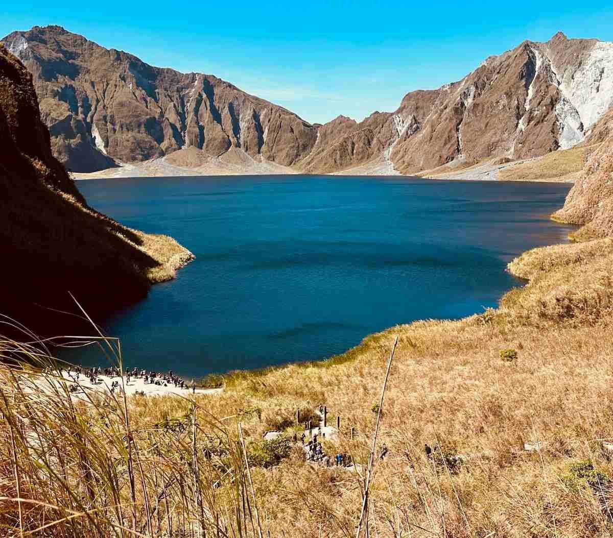
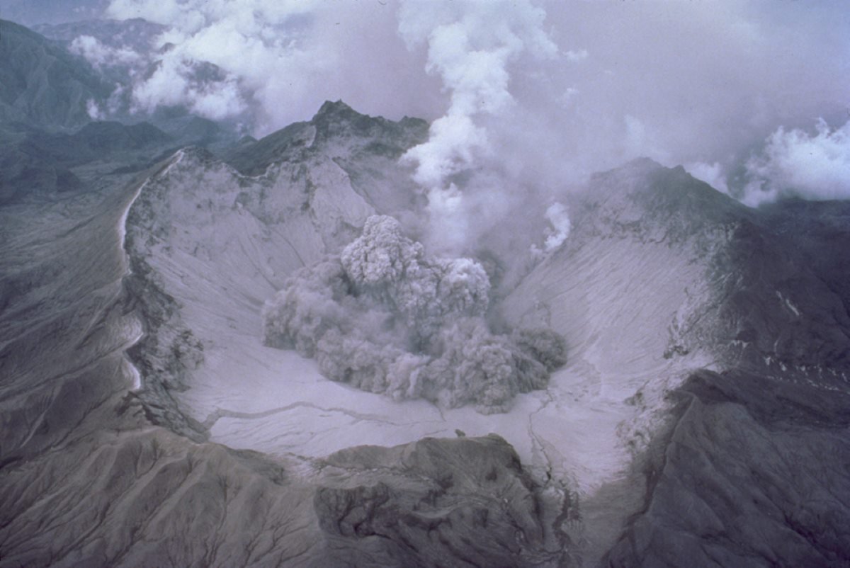
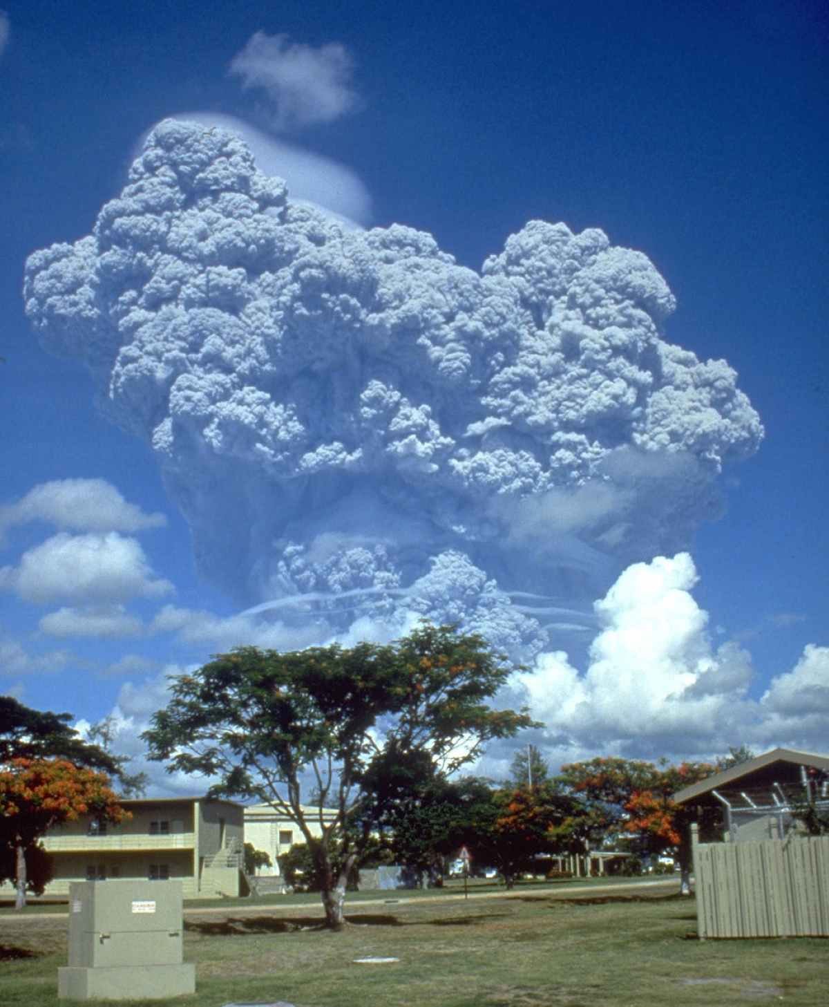
The 1991 volcanic eruption was one of the largest of the 20th century, ejecting more than 10 cubic kilometers of material into the atmosphere. The eruption column reached the stratosphere, and the volcanic ash was carried by winds across the globe, affecting global temperatures for years. The lahar flows that followed in the rainy seasons continued to reshape the landscape for years after the volcanic eruption. The eruption produced a massive caldera, approximately 2.5 kilometers in diameter, which later filled with water to form Lake Pinatubo. The volcanic eruption was primarily driven by the rapid ascent of magma rich in volatiles, leading to the explosive release of ash, pumice, and volcanic gases.
Mount Pinatubo is geologically linked to the Luzon Volcanic Arc, a series of volcanoes that arose due to the subduction of the South China Sea, which is part of the Eurasian Plate, beneath the Philippine Sea Plate along the Manila Trench. This tectonic process has given rise to a complex volcanic system, with Mount Pinatubo standing out as a significant feature. The mountain’s development has gone through multiple phases of volcanic activity, leading to a structure composed of layers of lava flows, pyroclastic materials, and lahar deposits.
The global impact of the 1991 eruption was profound, with the sulfur dioxide (SO2) ejected into the stratosphere causing a temporary decrease in global temperatures by about 0.5 degrees Celsius over the following years. The volcanic eruption also led to widespread ashfall, pyroclastic flows, and lahars, which caused significant destruction and loss of life in the surrounding areas.
Geographical Facts and Unique Features
Mount Pinatubo is located approximately 90 kilometers northwest of Manila, making it one of the most accessible volcanoes from the capital city. Pinatubo’s volcanic eruption in 1991 wasn’t just a local disaster; it was a global event. The eruption caused massive pyroclastic flows that buried entire towns, while the ashfall affected over 10 million people across Luzon, causing roofs to collapse, crops to fail, and a massive displacement of the population.
The region around Pinatubo is characterized by a rugged terrain, with deep valleys and steep ridges formed by the extensive lahar flows that followed the 1991 volcanic eruption. These lahars, a mixture of volcanic ash and water, were triggered by typhoons and heavy rains, causing rivers to overflow and burying entire towns under meters of volcanic debris destroying infrastructure and agricultural lands.
One of the most striking geographical features of Mount Pinatubo is Lake Pinatubo, the crater lake formed after the 1991 eruption. The lake is situated at an elevation of 900 meters and has a maximum depth of 600 meters, making it one of the deepest lakes in the Philippines. The turquoise waters of Lake Pinatubo are highly acidic, with a pH of around 2.5, due to the dissolution of volcanic gases such as sulfur dioxide in the water. Despite this, the lake has become a popular destination for tourists and adventurers.
The landscape surrounding Mount Pinatubo is marked by a stark contrast between the desolate ash-covered slopes and the lush vegetation that has begun to reclaim the area. The region is home to a variety of plant species, including grasses, shrubs, and trees that have adapted to the nutrient-rich volcanic soils. The recovery of vegetation in the post-eruption landscape is a testament to the resilience of nature.
Since the eruption, Mount Pinatubo has remained quiet, with only minor seismic activity and steam emissions observed. However, the threat of lahars continues, particularly during the rainy season, when heavy rains can remobilize the vast quantities of volcanic ash and debris deposited by the volcanic eruption. The government has implemented extensive lahar control measures, including the construction of dikes and dams, to protect communities living in the affected areas.
Damage Caused by Mount Pinatubo’s Volcanic Eruption
The 1991 eruption of Mount Pinatubo was one of the most explosive volcanic events in recent history. It released an estimated 10 billion tons of magma and 20 million tons of sulfur dioxide into the atmosphere. This massive outpouring caused global temperatures to fall by around 0.5°C for a few years. The volcanic eruption devastated the Philippines, resulting in over 800 fatalities, displacing 200,000 residents, and causing approximately $700 million in damages. The eruption also had a significant impact on global climate, influencing weather patterns around the world.
Major Tourist Attractions
Mount Pinatubo has transformed from a site of devastation to a popular tourist destination, drawing visitors from around the world to witness its dramatic landscape and to learn about the events surrounding the 1991 volcanic eruption. The main attraction is the trek to Lake Pinatubo, which can be accessed via a 4×4 jeep ride followed by a hike through the rugged terrain of lahar deposits and volcanic canyons.
The trek to the crater is an adventure in itself, offering stunning views of the surrounding landscape, including the remnants of volcanic flows and the lush greenery that has begun to reclaim the area. The final approach to the crater involves a steep climb, but the sight of the turquoise waters of Lake Pinatubo nestled within the caldera is a rewarding experience.
Beyond trekking, Mount Pinatubo provides various other activities, such as off-road expeditions, camping, and cultural excursions. The area around the volcano is inhabited by the indigenous Aeta people, who have resided there for generations and maintain a strong bond with the land. Visitors have the opportunity to explore the Aeta’s traditional lifestyle, learn about their remarkable resilience during the 1991 volcanic eruption, and see how they continue to rebuild and preserve their communities today.
For those interested in history and geology, the Pinatubo Museum in Clark Freeport Zone provides an in-depth look at the 1991 eruption and its impact on the region. The museum features exhibits on the science of volcanology, the human stories of those affected by the volcanic eruption, and the recovery and rehabilitation efforts that followed. The lahar fields surrounding Mount Pinatubo have also become popular destinations for off-road enthusiasts. The vast, ash-covered plains provide an ideal setting for 4×4 adventures and ATV rides, with opportunities to explore the unique landscape shaped by the volcanic eruption.
Local Folklore
Mount Pinatubo plays an important role in the folklore and spiritual beliefs of the indigenous Aeta people, who consider the volcano a sacred place. In Aeta mythology, the mountain is believed to be the dwelling of Apo Namalyari, a powerful deity who governs natural forces. The eruption of the volcano is thought to be an expression of Apo Namalyari’s displeasure or a warning to the people, reflecting the deep cultural significance the Aeta attach to Mount Pinatubo.
One of the most enduring legends associated with Mount Pinatubo is that of the “Great Snake” or “Ulupong,” a mythical serpent said to reside within the mountain. The Aeta believe that the snake guards the treasures of the volcano and that its movements can cause earthquakes and volcanic eruptions. This legend reflects the deep connection between the Aeta people and the natural world, as well as their respect for the powerful forces of the volcano.
2. Taal Volcano: The Smallest, Deadliest Giant
Geological Facts
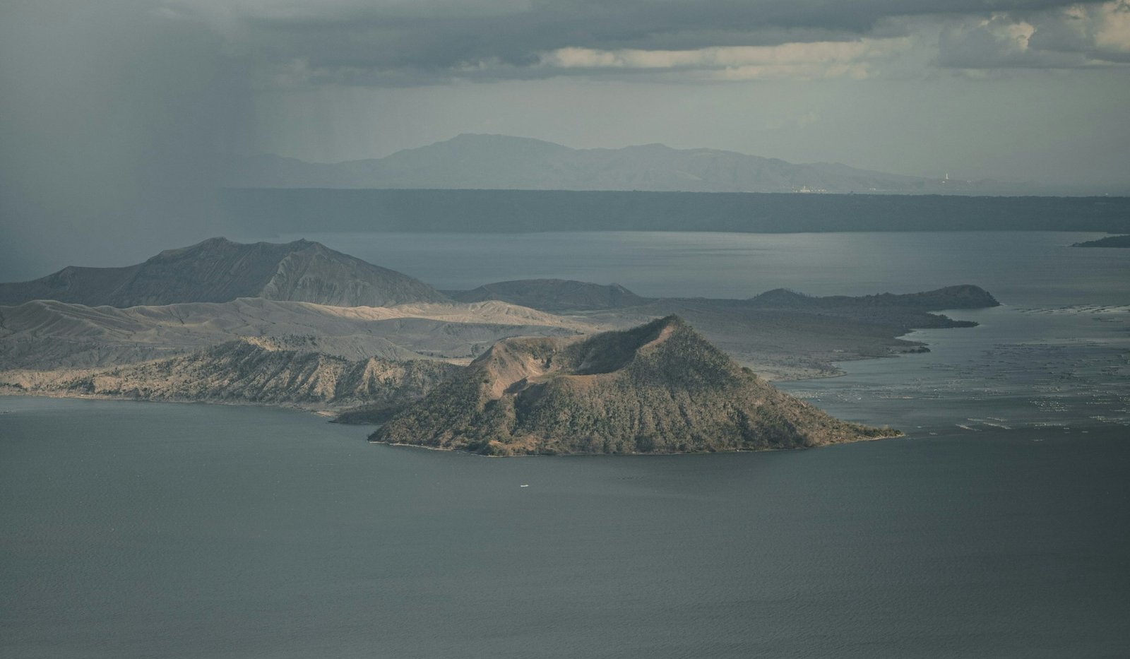
Taal Volcano, located on the island of Luzon in the province of Batangas, is one of the Philippines’ most active and intriguing volcanoes. What makes Taal particularly unique is its geographical setting: it is a volcano within a lake, situated on an island in a larger caldera lake known as Taal Lake. This complex structure results from multiple volcanic eruptions over millennia, leading to the formation of several overlapping calderas and cones.
Taal is a stratovolcano, formed by the subduction of the Eurasian Plate beneath the Philippine Sea Plate along the Manila Trench. This tectonic activity generates magma, which rises through the Earth’s crust and leads to volcanic activity. Taal’s volcanic island, known as Volcano Island, is composed of multiple eruptive centers, with the main crater lake being the most prominent feature.
The caldera that forms Taal Lake was created by prehistoric eruptions that were among the largest in history, with the most significant volcanic eruption occurring around 100,000 to 500,000 years ago. This cataclysmic event emptied the magma chamber beneath the volcano, causing the ground to collapse and form the large caldera, which subsequently filled with water to create the lake.
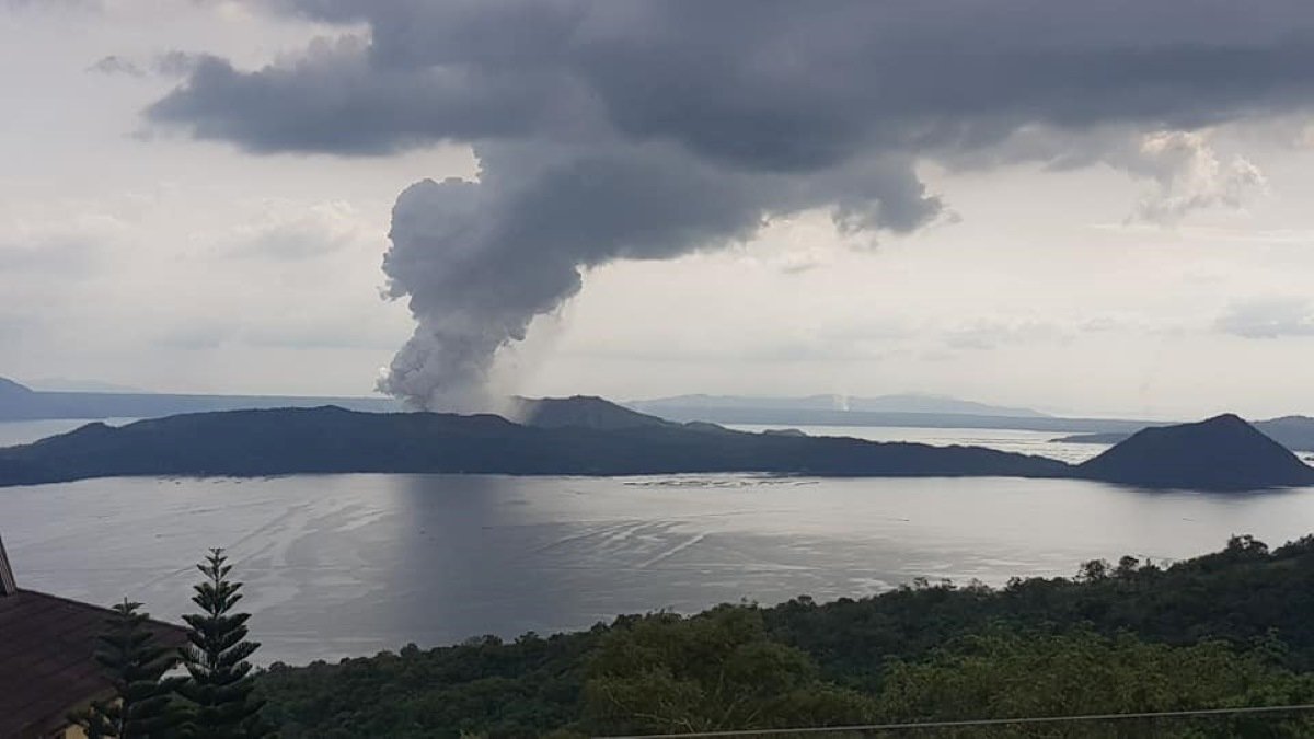
Taal has had 38 recorded eruptions since 1572, making it one of the most active volcanoes in the Philippines. The most recent significant volcanic eruption occurred in January 2020, when a phreatomagmatic explosion—caused by the interaction of magma with water—generated a massive ash plume, pyroclastic flows, and volcanic lightning. This eruption led to widespread ashfall in nearby provinces, prompting the evacuation of tens of thousands of people.
The geological structure of Taal is characterized by a series of fissures and vents that allow magma to reach the surface. These features contribute to the volcano’s complex eruption patterns, which can vary from effusive lava flows to explosive volcanic eruptions that produce ash clouds, pyroclastic flows, and volcanic tsunamis within Taal Lake.
Geographical Facts and Unique Features
Taal Volcano is located approximately 60 kilometers south of Manila, making it one of the most accessible volcanoes in the Philippines. The volcano’s island, Volcano Island, sits in the middle of Taal Lake, which itself fills a large caldera measuring about 25 kilometers in diameter. The lake is relatively shallow, with an average depth of around 2 meters, though it reaches deeper points at certain locations.
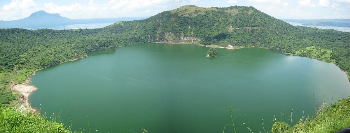
One of the unique features of Taal Volcano is its double-caldera system. The larger caldera, which forms Taal Lake, encloses a smaller, active volcanic island. The main crater lake, found within Volcano Island, is a strikingly beautiful greenish-blue body of water, which occupies the primary vent of the volcano. This crater lake, known as the “Crater Lake” or “Main Crater Lake,” is approximately 1.9 kilometers in diameter and about 160 meters deep. The acidic waters of the lake, combined with the presence of fumaroles and hot springs, indicate ongoing volcanic activity beneath the surface.
Taal’s eruptions are often phreatomagmatic, meaning they result from the interaction of magma with water. These types of volcanic eruptions are particularly dangerous because they can produce explosive steam-driven blasts, ashfall, and pyroclastic surges. The 1965 eruption, for example, generated pyroclastic surges that swept across the lake, devastating nearby communities and causing significant loss of life.
In addition to its explosive eruptions, Taal has also produced volcanic lightning, a phenomenon where ash particles in the eruption plume generate static electricity, leading to bolts of lightning within the ash cloud. This was notably observed during the 2020 volcanic eruption, adding to the dramatic visuals of the event.
The landscape around Taal is characterized by rolling hills, fertile plains, and volcanic deposits that have shaped the region over thousands of years. The area around the lake is densely populated, with several towns and cities located along the shoreline. This proximity to human settlements makes Taal one of the most closely monitored volcanoes in the Philippines, with the Philippine Institute of Volcanology and Seismology (PHIVOLCS) maintaining a permanent observatory on Volcano Island.
Damage Caused by Taal’s Volcanic Eruption
Taal Volcano’s eruption in 1911 was one of its deadliest, killing approximately 1,335 people and destroying several villages. The volcanic eruption was powerful enough to be felt hundreds of kilometers away and created a massive crater that reshaped the landscape of the Taal Lake area. The ashfall reached as far as Manila, and the event had long-lasting impacts on agriculture and settlement patterns in the region.
Major Tourist Attractions
Taal Volcano is a major tourist destination, attracting visitors with its stunning natural beauty, unique geological features, and the adventure of hiking to the crater. The most popular activity for tourists is trekking to the crater of Taal Volcano. The trail to the crater is relatively short but steep, winding through volcanic ash deposits, rocky terrain, and sparse vegetation. The reward at the end of the hike is the breathtaking view of the crater lake, with its vivid colors and otherworldly landscape.
In addition to the main crater, visitors can explore the smaller “Binintiang Malaki” crater, which is a prominent cinder cone located on the northwest side of Volcano Island. Binintiang Malaki is often mistaken for the main crater due to its visibility from the shore and its picturesque appearance, which has made it a popular subject for postcards and photographs.
For those who prefer not to hike, boat tours are available that take visitors around Volcano Island and Taal Lake, offering different perspectives of the volcano and its surrounding landscape. Some tours also include stops at the nearby Pulo Island, which features the Taal Lake Yacht Club, where visitors can enjoy sailing, kayaking, and other water sports.
The towns surrounding Taal Lake, particularly Tagaytay City, offer stunning panoramic views of the volcano and lake. Tagaytay is a popular weekend destination for residents of Metro Manila, known for its cool climate, scenic vistas, and a wide range of restaurants and cafes that capitalize on the views of Taal.
The area surrounding Taal is celebrated for its vibrant cultural legacy. The town of Taal in Batangas, for example, is renowned for its preserved Spanish colonial architecture, including the impressive Taal Basilica, which is the largest Catholic church in Asia. Visitors can immerse themselves in local history by exploring historic homes, museums, and heritage sites that highlight the rich cultural and historical tapestry of the region.
Conservation efforts are ongoing to protect Taal Volcano and its surrounding environment. Due to its frequent volcanic eruptions and the potential hazards posed to nearby communities, PHIVOLCS and local government units work together to monitor the volcano and implement disaster preparedness measures. In addition, there are efforts to preserve the natural beauty of the lake and island, including initiatives to control pollution, manage tourism sustainably, and protect the area’s biodiversity.
Local Folklore
Taal Volcano, like many other natural landmarks in the Philippines, is steeped in local folklore and myths. One of the most enduring legends surrounding Taal is the story of “Taal, the Restless Giant.” According to this legend, Taal Volcano was once a mighty giant who lived in the Batangas region. The giant’s restless nature caused frequent volcanic eruptions and earthquakes, as he would shake the ground and throw fits of rage.
The local people, fearing the giant’s wrath, would offer sacrifices to appease him. Eventually, the giant’s spirit was sealed within the volcano, but his anger would still manifest as eruptions whenever he was disturbed.
Another piece of folklore relates to the origin of Taal Lake. It is said that the lake was formed by a great flood sent by the gods to punish the people for their greed and arrogance. The floodwaters covered the land, leaving only the volcano’s peak visible above the surface. Over time, the waters receded, forming the caldera lake that we see today.
3. Mount Mayon: The Perfect Cone
Geological Facts
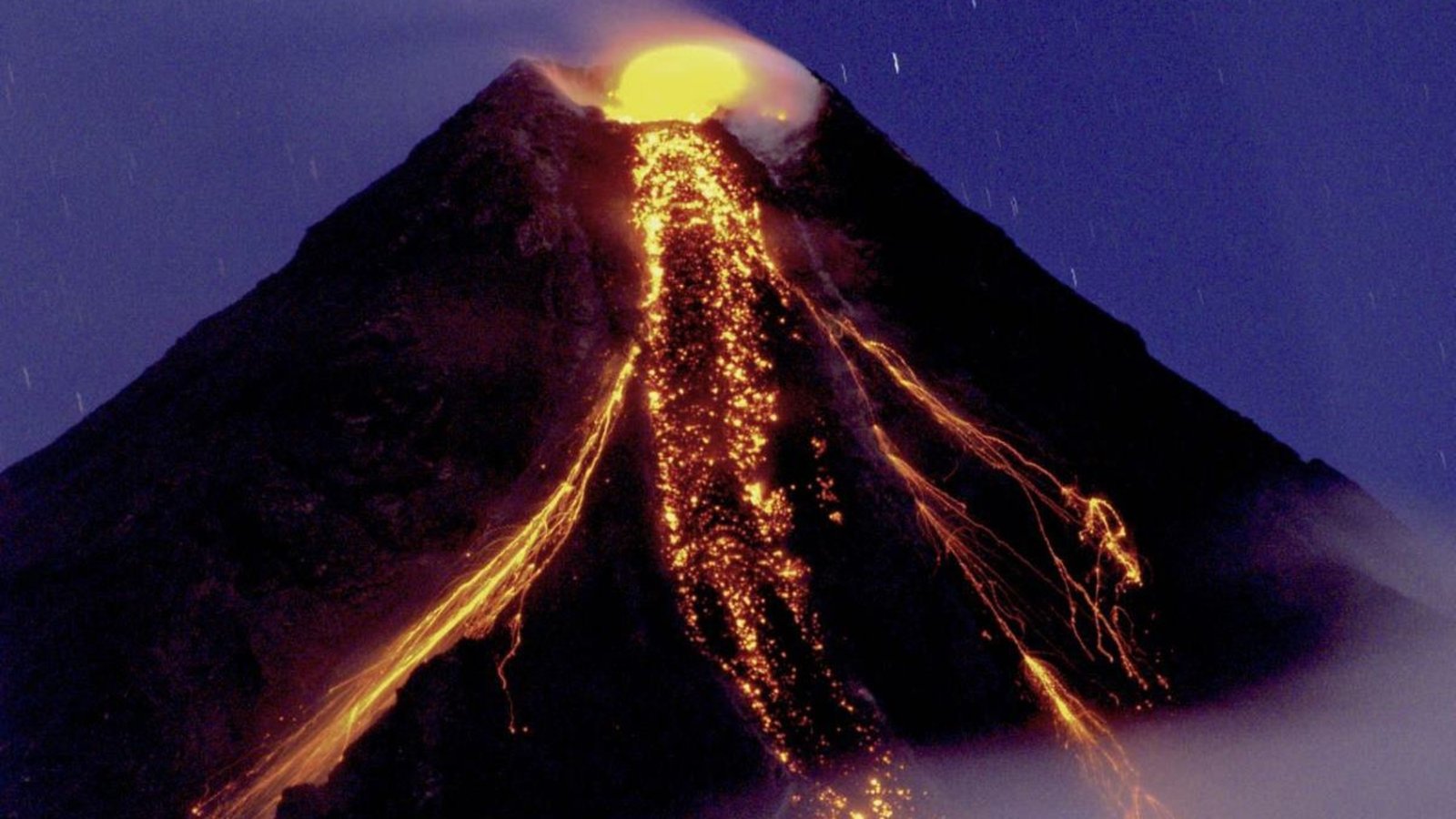
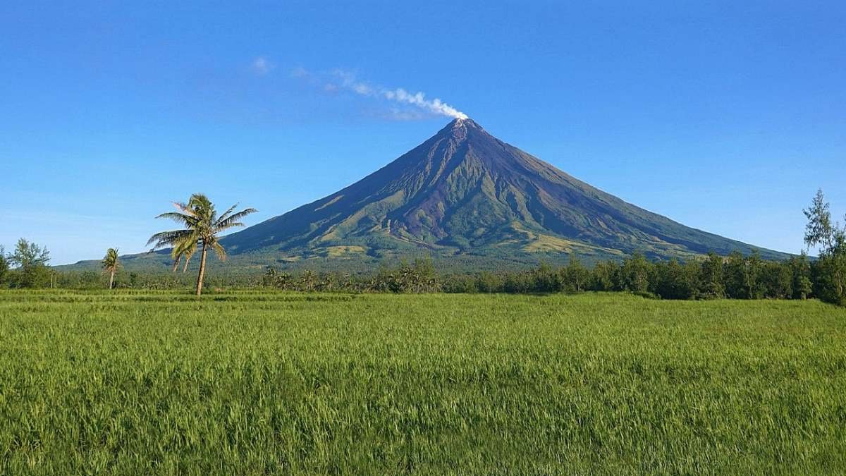
Mount Mayon, situated in Albay province on Luzon Island, is one of the most recognizable volcanoes in the Philippines due to its nearly symmetrical conical form. As an active stratovolcano, Mayon rises to 2,462 meters above sea level. It is located within the Pacific Ring of Fire, an area famed for its high seismic activity and numerous volcanoes, which result from the subduction of the Philippine Sea Plate beneath the Eurasian Plate.
Mayon’s symmetrical cone is the result of repeated layers of pyroclastic flows, lava flows, and tephra deposits, all products of its frequent volcanic eruptions. The volcano’s activity is closely tied to the tectonic processes in the region, particularly the Manila Trench, where the Philippine Sea Plate is being subducted. This subduction leads to the melting of mantle material, creating magma that rises to the surface and erupts through the volcanic vent.
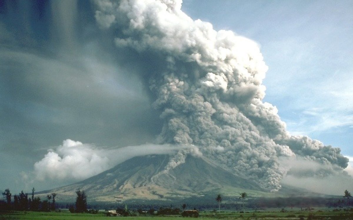
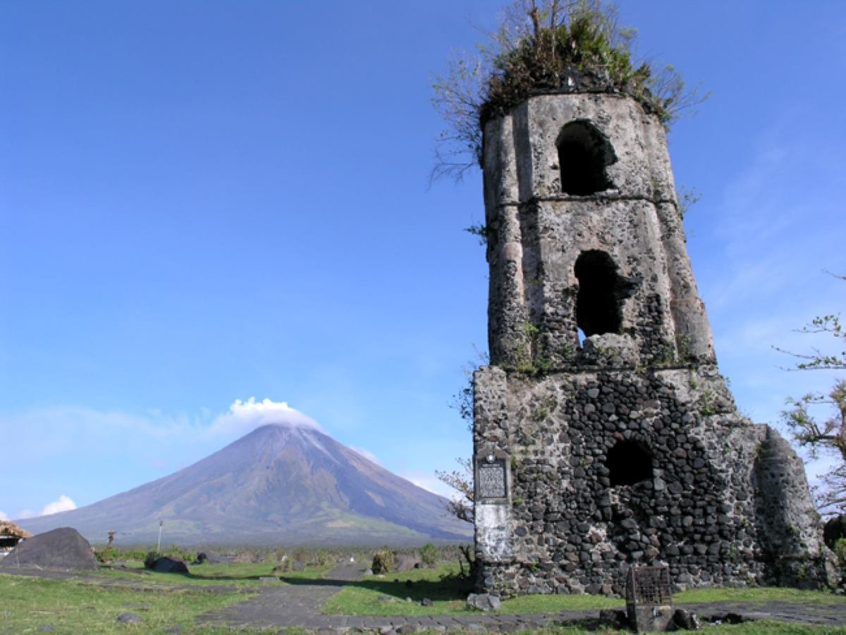
Mount Mayon, part of the UNESCO Albay Biosphere Reserve, has a long history of volcanic activity with its first recorded eruption occurring in 1616 and over 50 volcanic eruptions documented since then. It stands out as one of the Philippines’ most active volcanoes. The most catastrophic eruption happened in 1814, when a powerful explosion covered the town of Cagsawa in several meters of volcanic material. Today, the Cagsawa Ruins, including the remains of a church bell tower, remain a poignant reminder of this devastating event.
Mount Mayon’s eruptions are characterized by the effusion of basaltic and andesitic lavas, which are relatively low in viscosity and tend to flow easily down the slopes of the volcano. However, Mayon is also capable of producing explosive volcanic eruptions, which generate pyroclastic flows, ashfall, and lahars. These explosive events are often preceded by an increase in seismic activity, ground deformation, and gas emissions, allowing scientists to monitor the volcano and provide warnings to nearby communities.
Geographical Facts and Unique Features
Mount Mayon is located in the Mayon Volcano Natural Park, a designated conservation area that spans about 5,775 hectares. This park is part of the Bicol region, which is renowned for its verdant scenery, diverse wildlife, and lively cultural heritage. The volcano’s perfectly symmetrical cone is a prominent feature of Albay’s landscape, visible from various locations throughout the province.
One of the unique features of Mount Mayon is its perfectly symmetrical shape, which has made it a subject of fascination for both locals and visitors. The volcano’s near-perfect cone is the result of its frequent volcanic eruptions, which have built up the layers of lava and pyroclastic material that form its slopes. This symmetry is rare among volcanoes, as most tend to have irregular shapes due to the varying types of eruptions and the influence of erosion.
Mayon’s eruptions are famous not only for their regularity but also for their intensity. The volcano is particularly noted for its pyroclastic flows—swift, scorching currents of gas, ash, and volcanic fragments that descend the slopes during explosive events. These flows can travel at speeds of up to 100 kilometers per hour and reach temperatures around 1,000 degrees Celsius, presenting extreme hazards. The destructive power of these pyroclastic flows has led to considerable damage and loss of life in previous volcanic eruptions.
The surrounding area of Mount Mayon is characterized by fertile soils, which have been enriched by the volcanic ash and other materials deposited by the volcano over centuries. This has led to the development of extensive agricultural lands, particularly for crops like rice, coconut, and abaca (Manila hemp). The region’s agriculture is highly dependent on the nutrient-rich soils provided by the volcano, despite the risks posed by its frequent volcanic eruptions.
In addition to its nutrient-rich soils, the Mayon Volcano Natural Park is a haven for diverse plant and animal species. The tropical rainforests on the lower slopes of the volcano are home to a variety of flora and fauna, including numerous birds and mammals. The park also serves as a vital watershed, supplying water to local communities and supporting nearby agricultural activities.
Damage Caused by Mount Mayon’s Volcanic Eruption
The 1814 eruption of Mount Mayon is considered its most catastrophic event. During this eruption, lava flows overwhelmed the town of Cagsawa, resulting in the deaths of approximately 1,200 individuals. The remains of the Cagsawa Church are still visible today, serving as a historical marker of the disaster. The volcanic eruption had extensive repercussions, destroying crops and infrastructure, which subsequently led to widespread famine and disease outbreaks in the affected areas.
Major Tourist Attractions
Mount Mayon is a major tourist attraction in the Philippines, drawing visitors with its stunning landscapes, vibrant cultural history, and numerous adventure activities. Among its notable sites, the Cagsawa Ruins stand out. This location provides a moving testament to the 1814 volcanic eruption, with the bell tower of the former Cagsawa Church remaining as the sole visible remnant, while the rest of the town was covered by volcanic material.
Mount Mayon provides a range of hiking trails for adventurers of varying skill levels. The most well-known trek is the climb to the summit, which guides hikers through dense forests, rugged slopes, and volcanic landscapes to the crater’s edge. From the top, trekkers are rewarded with sweeping views of the Bicol Peninsula, the Pacific Ocean, and neighboring islands. Because of the volcano’s active status, summit climbs are permitted only when seismic activity is minimal, and hikers must secure permits from local authorities before embarking on the journey.
The Mayon Volcano Natural Park is also a haven for birdwatchers and nature lovers, with its diverse ecosystems providing habitat for a variety of species. The park is home to endemic birds such as the Philippine hawk-eagle, the flame-breasted fruit-dove, and the Bicol ground warbler. The forests surrounding the volcano are also rich in plant life, with numerous species of orchids, ferns, and trees that are unique to the region.
In addition to hiking and nature exploration, visitors to Mount Mayon can enjoy cultural experiences in the nearby towns and cities. Legazpi City, the capital of Albay province, is known for its vibrant festivals, such as the Ibalong Festival, which celebrates the region’s epic history and legends. The Daraga Church, a Baroque-style church built in the 18th century, offers stunning views of Mount Mayon and is a popular spot for photography and sightseeing. The region’s culture is deeply intertwined with Mayon, inspiring numerous works of art, literature, and music that celebrate both its beauty and its destructive power.
For those interested in geology and volcanology, the Philippine Institute of Volcanology and Seismology (PHIVOLCS) operates a monitoring station at the foot of Mount Mayon. Visitors can learn about the science of volcano monitoring, the history of Mayon’s eruptions, and the ongoing efforts to mitigate the risks posed by the volcano.
Local Folklore
Mount Mayon is deeply ingrained in the local folklore of the Bicol region, with numerous myths and legends surrounding the volcano. One of the most famous stories is the legend of Daragang Magayon, which translates to “Beautiful Maiden.” According to the legend, Daragang Magayon was a stunningly beautiful woman who fell in love with a warrior named Panganoron. However, their love was opposed by another suitor, Patuga, who kidnapped Magayon, leading to a tragic battle that ended in the deaths of both Magayon and Panganoron. Overcome with grief, the gods turned Magayon into a mountain, and her lover’s spirit into the clouds that often shroud the volcano’s peak.
The story of Daragang Magayon is seen as an explanation for the volcano’s perfect shape, with the mountain representing the maiden’s final resting place. The frequent volcanic eruptions of Mount Mayon are believed to be expressions of the maiden’s sorrow or anger. The legend has become an integral part of the cultural identity of the Bicolano people and is celebrated through various cultural expressions, including the Daragang Magayon Festival, held annually in Albay.
Summary
The archipelago’s volcanic landscape is as thrilling as it is treacherous. From the explosive awakening of Mount Pinatubo to the perilous beauty of Taal Volcano and the iconic symmetry of Mount Mayon, these natural giants have etched their mark on both the land and the lives of those who dwell in their shadows.
The 1991 volcanic eruption of Mount Pinatubo not only transformed the geography of Luzon but also captured the world’s attention with its explosive power and global impact. Its caldera, now a serene lake, offers a stark reminder of nature’s ability to both destroy and renew. Meanwhile, Taal Volcano, with its unique double-caldera structure and frequent, dramatic eruptions, continues to intrigue and intimidate, a volatile beauty nestled within a lake.
The volcanic eruption of Taal in 2020, with its ash plumes and volcanic lightning, was a vivid testament to its unpredictable fury. And then there’s Mount Mayon, with its flawless conical form, symbolizing both the splendor and danger of volcanic activity. Its eruptions, like the catastrophic one in 1814, remind us of the destructive power of nature, while its cultural legends add layers of mystique to its allure.
These volcanoes are not just geological features; they are living legends that have shaped the Philippines’ landscape and history. They tell stories of devastation, resilience, and recovery, offering an ever-changing canvas that draws adventurers, scientists, and curious minds alike.
But here’s the ultimate truth: these volcanic wonders are not merely relics of the past; they are still very much alive and ready to reveal their secrets to those daring enough to explore their realms. If you’re looking for a travel experience that combines breathtaking natural beauty with thrilling adventure and profound historical significance, then the volcanoes of the Philippines should top your bucket list. Their eruptions might have reshaped the world, but the real adventure lies in witnessing their magnificent legacy firsthand.

